
Missouri Map
|
 |
 |
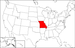
Where Is Missouri?
The map to the right displays the location of Missouri in red. The State of Missouri is bounded by Iowa on the north, by Arkansas on the south, by Kentucky on the east, and by Kansas on the west. It is bounded by Illinois on the northeast, by Tennessee on the southeast, by Nebraska on the northwest, and by Oklahoma on the southwest.
Missouri Maps
Missouri is the 18th largest state in the United States, and covers a land area of 68,886 square miles (178,415 square kilometers). Missouri is divided into 114 counties. This Missouri map site features road maps, topographical maps, and relief maps of Missouri. The detailed, scrollable road map displays Missouri counties, cities, and towns as well as Interstate, U.S., and Missouri state highways. The pannable, scalable Missouri street map can be zoomed in to show local streets and detailed imagery.
Missouri Highway Map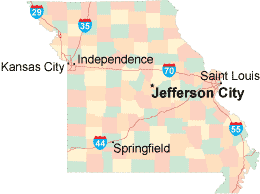 Click on the highway map thumbnail
to view a scalable Missouri road map. |
MO Topo Map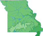 Click map to enlarge.
|
MO Relief Map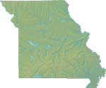 Click map to enlarge.
|
The detailed Missouri map and the regional Missouri map display cities, roads, rivers, and lakes as well as terrain features. The detailed map shows only the State of Missouri, while the regional map shows Missouri and the surrounding region.
Missouri Infrastructure > Missouri Airports
In 2005, the population of Missouri was estimated at 5,797,703, which is about 84.2 people per square mile. In 2010, Missouri's population rose to 5,988,927 people. More recently, in the 2020 census, the Missouri population was 6,154,913. The state's Interstate Highways include I-29, I-35, I-44, I-55, and I-70.
Missouri Topography and Attractions
Missouri was named after a Native American tribe which lived in the region. The tribe's name meant "town of the large canoes". Northern Missouri is prairie country, where farmers grow corn and raise livestock. The Missouri, Ohio, and Mississippi Rivers converge in southeastern Missouri to form a floodplain; the Ozark Plateau and its foothills are located to the southwest. Visitors flock to Branson for its live music shows. Major landmarks include the Gateway Arch in Saint Louis, the George Washington Carver National Monument, and the Harry Truman and Ulysses Grant National Historic Sites. For more Missouri travel and tourism information, visit the official Missouri tourism site and Missouri Atlas.
Other Missouri Maps
This online Missouri reference map shows major cities, roads, railroads, and physical features in Missouri.Several map publishing companies offer printed maps of Missouri. For example, Omni Resources offers several maps of Missouri that feature points of interest, airports, and parks, as well as selected local attractions and insets of major Missouri cities.
All rights reserved.
Certain maps hereon are © Map Resources or Digital Wisdom.
To facilitate browsing, certain external links will open in new windows.
Missouri-Map.org Editor, State Maps, PO Box 828, Barnegat, NJ 08005.